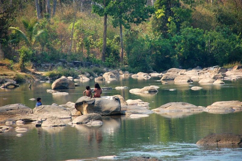
Photo by Corto Maltese 1999 on Wikimedia Commons · CC BY 2.0
Tad Suong and Tad Katamtok
Tad Suong, spectacular in the rainy season, and Tad Katamtok, in full flow all year round.
Bolaven PlateauRain eases in the north, 195 mm in Luang Prabang against 313 in August, but stays heavy in the south. The Mekong is at its highest: the flood peak often comes in early September. It's still the green season.

| Month | J | F | M | A | M | J | J | A | S (current month) | O | N | D |
|---|---|---|---|---|---|---|---|---|---|---|---|---|
| Airhigh / low | ||||||||||||
| Rainmm | ||||||||||||
| Daysof rain | 3 | 2 | 6 | 12 | 20 | 23 | 26 | 28 | 23 | 12 | 5 | 3 |
| Mekonglevel | Low | Low | Low | Low | Low | Rising | Rising | High | High | Falling | Low | Low |
| Month | Low – high | mm | River |
|---|---|---|---|
| Jan | 20 | Low | |
| Feb | 10 | Low | |
| Mar | 35 | Low | |
| Apr | 82 | Low | |
| May | 142 | Low | |
| Jun | 179 | Rising | |
| Jul | 288 | Rising | |
| Aug | 313 | High | |
| Sep (current month) | 195 | High | |
| Oct | 71 | Falling | |
| Nov | 23 | Low | |
| Dec | 20 | Low |
| Month | J | F | M | A | M | J | J | A | S (current month) | O | N | D |
|---|---|---|---|---|---|---|---|---|---|---|---|---|
| Airhigh / low | ||||||||||||
| Rainmm | ||||||||||||
| Daysof rain | 2 | 2 | 6 | 12 | 23 | 25 | 27 | 28 | 25 | 12 | 3 | 1 |
| Mekonglevel | Low | Low | Low | Low | Low | Rising | Rising | High | High | High | Falling | Low |
| Month | Low – high | mm | River |
|---|---|---|---|
| Jan | 11 | Low | |
| Feb | 14 | Low | |
| Mar | 38 | Low | |
| Apr | 76 | Low | |
| May | 254 | Low | |
| Jun | 312 | Rising | |
| Jul | 372 | Rising | |
| Aug | 409 | High | |
| Sep (current month) | 310 | High | |
| Oct | 102 | High | |
| Nov | 22 | Falling | |
| Dec | 8 | Low |
| Month | J | F | M | A | M | J | J | A | S (current month) | O | N | D |
|---|---|---|---|---|---|---|---|---|---|---|---|---|
| Airhigh / low | ||||||||||||
| Rainmm | ||||||||||||
| Daysof rain | 1 | 1 | 5 | 11 | 23 | 27 | 29 | 29 | 27 | 17 | 5 | 1 |
| Mekonglevel | Low | Low | Low | Low | Low | Rising | Rising | High | High | High | Falling | Low |
| Month | Low – high | mm | River |
|---|---|---|---|
| Jan | 2 | Low | |
| Feb | 4 | Low | |
| Mar | 25 | Low | |
| Apr | 54 | Low | |
| May | 191 | Low | |
| Jun | 315 | Rising | |
| Jul | 446 | Rising | |
| Aug | 451 | High | |
| Sep (current month) | 343 | High | |
| Oct | 138 | High | |
| Nov | 36 | Falling | |
| Dec | 6 | Low |
September is often the month of the flood peak: September 1, 2018 in Luang Prabang, September 3 in Vientiane, and Luang Prabang's record on September 2, 1966 (22.36 m), according to the Mekong River Commission. In September 2024, after Typhoon Yagi, the river rose above danger level in Luang Prabang.
Luang Prabang, at the confluence →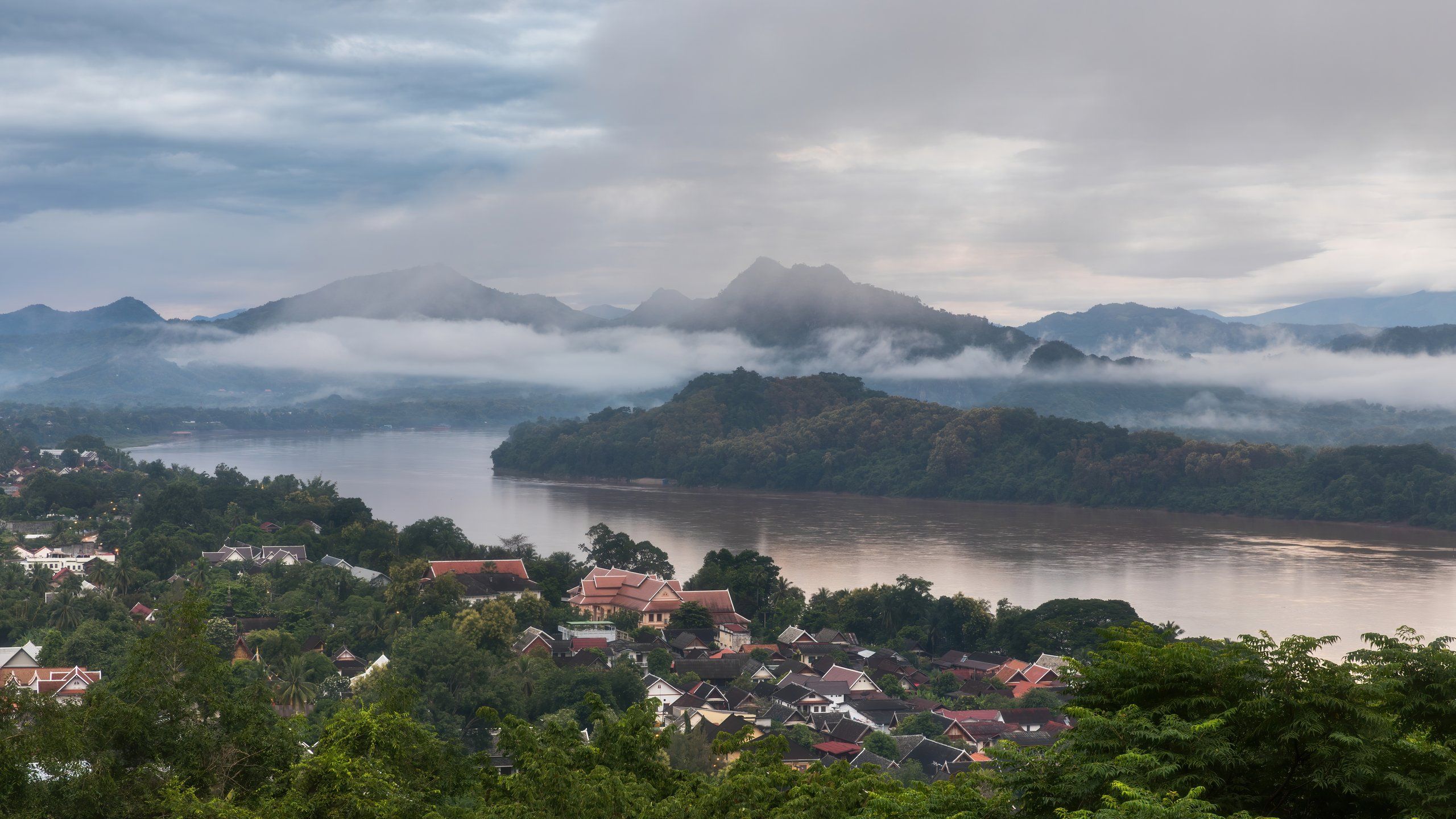
Photo by Basile Morin on Wikimedia Commons · CC BY-SA 4.0
Two weeks after Khao Padap Din, the second festival of the dead: offerings to the monks for the departed in the morning, a candlelit procession in the evening.
Photo by Corto Maltese 1999 on Wikimedia Commons · CC BY 2.0
Tad Suong, spectacular in the rainy season, and Tad Katamtok, in full flow all year round.
Bolaven Plateau
Photo by Rob te Braake on Unsplash
Offerings for the dead at first light, two weeks after Khao Padap Din: ask the temple for the time the day before.
Vientiane
Photo by Dick Hoskins on Pexels
The river at its highest and a strong current: check river conditions before you leave.
Huay Xai – Luang Prabang
Photo by Frank Eiffert on Unsplash
The Mekong and the Nam Khan in flood, below the peninsula.
Luang PrabangSources: climate, Open-Meteo (ERA5 archive, 1991-2020 averages); river levels, Mekong River Commission and Vientiane Times (September 2024); festivals, Tourism Laos calendar; 2027 dates, Kapook calendar; visitor numbers, 2024 statistics of the Lao tourism ministry; sights, KPL; safety and roads, FCDO. Updated October 13, 2026 by Pierre-Marie Coupry.